
The infrastructures and tools that bring research from the laboratory to the field
Technological and digital innovation
Want to understand how these technologies can support your business or a research project?

Controlled environments and experimental greenhouses
Growth chambers and phenotyping systems that allow the study of plants by precisely controlling every environmental variable.
Fitotroni
Growth chambers for plants in a controlled environment, inspired by the concept of vertical farming, suitable for conducting experiments that require the control of climatic variables. The chambers are located within recovered greenhouses near the buildings that make up the research hub.
Technical specifications:
- Central access lobby with access via side doors to the 2 adjacent grow rooms. Inside the lobby are the PLC terminals with which to operate and modify all variables. It will also be possible to use small equipment within the remaining space, which is also conditioned.
- 2 grow rooms with shelves with 2 and 4 cultivation levels (useful growth height between 25 and 40 cm). This choice is dictated by the need to be able to conduct experiments with either small-sized plants or at the beginning of the growth phase (4 shelves), or with larger-sized plants (2 shelves). Each grow room has a net area, including the central corridor, of approximately 24 m2.
- Artificial lighting system to provide different levels of radiation to the plants with a PPFD that reaches up to 1000 µmol/s/m2.
- Fertigation system using the ebb and flow method that provides 4 different nutrient solutions to the root systems.
- Air conditioning system to recreate the desired temperature and humidity conditions.
Applications: Plant growth experiments with the ability to accurately modulate all climatic variables (temperature, humidity, pressure, CO concentration)2, This allows for the testing of special conditions such as salt stress, thermal stress, the administration of special light recipes, and much more.
TraitFinder F600
Advanced phenotyping instrument produced by the Dutch company Phenospex that allows for the acquisition of images and the production of 3D models of the plants.
Technical specifications:
- The instrument consists of a cart that can be moved indoors; the total dimensions are 2.4×0.8×2.2 m.
- The heart of the instrument is 2 optical sensors (PlantEye F600) that, thanks to laser technology, perform a scan of the plants. These sensors can operate in dual-scan or single-scan mode.
- Resolution up to 0.3 mm to detect even the smallest sheet structures and a scanning speed of 25 mm/s.
- Through the HortControl software, more than 20 parameters are monitored, such as maximum height, leaf area, vegetation indices, etc.
- The useful scanning area is approximately 1.5 square meters, suitable for plants up to 1 m tall.
ApplicationsWith TraitFinder, it will be possible to obtain information on the phenotypic traits of the analyzed plants, which can assume specific conformations following certain treatments or growth conditions. It is also possible to reconstruct 3D models and calculate vegetation indices in real time with maximum accuracy.
Interested in controlled environments for your research?
Sensors and monitoring stations
Sentek Drill&Drop
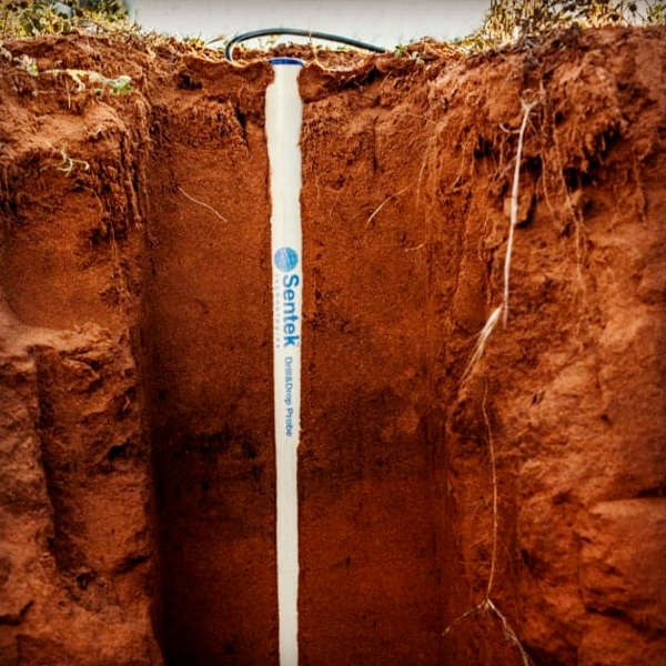
The Drill&Drop is a multi-sensor encased probe that is inserted into the ground. Its peculiarity, as the name suggests, is the conical shape that allows for quick installation without invasive excavations: the ground is dug out with a dedicated drill and the probe is inserted.
Technical specifications:
- Measured variables: volume content of water, temperature and salinity with resolutions of 1:10000, 0.3 °C and 1:3000, respectively
- Available in various lengths: 10, 30, 60, 90, 120 cm with fixed sensors every 10 cm
- Power supply with variable voltage between 4.5 and 15 V DC.
- Diameter ranging from 3 cm at the top and 2.4 cm at the tip. Weight ranging from 1.2 kg to 2.6 kg depending on size
ApplicationsIrrigation management with optimization of the water application cycles; monitoring of soil salinity over time, to obtain information on the behavior of the soil following a given operation; agricultural study and research on the interaction of the root-water system.
E-Leaf Netsens Leaf Wetness Sensor
This sensor simulates the physical and thermodynamic behavior of a real leaf, detecting the presence of water on its upper and lower surfaces. It allows to discriminate with precision between situations of total wetting and intermediate wetting conditions up to the absence of wetting.
Technical specifications:
- High-sensitivity resistive/capacitive sensor with a printed circuit board made of resin and a gold finish.
- Measuring range from 0% (fully dry leaf) to 100% (fully wet leaf) with a resolution of 1%
- Powered directly by the Netsens base stations
ApplicationsWith a sensor capable of accurately measuring foliar wetting, predictive models and decision support systems can be implemented in agriculture; optimizing the timing of phytosanitary treatments, leading to targeted use of products and savings; monitoring fog and dew to accurately identify areas at risk of waterlogging or frost.
Weather stations Netsens
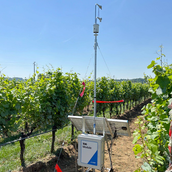
Nestens weather stations are a set of tools for measuring specific climatic variables. They provide real-time data on the meteorological conditions at the point where they are installed. They consist of various sensors that convert the measured physical quantities into data, and data loggers that collect, digitize, and transmit these signals. The stations can be customized based on which measurement is required.
Technical specifications:
- Measurable dimensions:
– relative humidity with a range of 0% ÷ 100% and sensitivity ±2%
– atmospheric pressure with a range of 300 ÷ 1100 hPa and sensitivity ± 0.5 hPa
– wind speed up to 200 km/h
– leaf wetting from 0% to 100% with sensitivity ±1%
– soil moisture from 0% to 100% with a sensitivity of 0.1%.
- Power supply with photovoltaic panel and 4G transmission to download data remotely
ApplicationsPrecision agriculture, allowing the measurement of key climatic variables, makes it possible to obtain accurate information to optimize interventions; irrigation management, to provide the right amount of water to crops; and the possibility of obtaining or refining any models to support decisions in agriculture.
Do you want to design a monitoring network for your fields?
Field instruments for research
Portable and precision instrumentation for measuring plant physiology, gas flows, and the structure of vegetation in the field.
Fluorometer/Porometer LI-600
The LI-600 fluorometer/porometer is a tool that allows you to simultaneously measure chlorophyll fluorescence and stomatal conductance. It is an ergonomic and lightweight instrument that can be used directly in the field. There are a total of 2 devices available.
Technical specifications:
- Measurement of gastric conductivity (0 ÷ 2500 ± 10%) mmol/m2/s
- Fluorescence, PAR and temperature measurement
- Battery with 8 hours of autonomy
- Weight 680 g
ApplicationsWith the LI-600 it is possible to perform genetic screenings quickly on different genotypes, monitor the water stress of plants in real time, or evaluate the performance of transpiration and photosynthesis.
Share SLAM s20
Mobile laser scanning system based on SLAM (Simultaneous Localization and Mapping) technology that, through LIDAR sensors, allows the mapping of environments with a complex three-dimensional structure, generating dense point clouds
Technical specifications:
- 360° rotating laser with a maximum range of 120 m
- 320,000 points scanned per second
- Visual module for coloring the point cloud
- Weight of 1.1 km and battery with approximately 2 hours of autonomy
ApplicationsRapid and accurate mapping of complex and articulated environments, calculation of the plant biomass of plants with particular shapes and structures.
Smart Chamber LI-78SC with gas analyzers
One of the standards for measuring gas flows from the ground. The chamber is designed to handle data intelligently, integrating control electronics and maintaining internal pressure equal to that of the outside.
Technical specifications:
- Covered area equal to 317.8 cm2 and volume of 4244.1 cubic meters3
- Weight of 4.3 kg and battery with 12 hours of autonomy
- CH measurement collars4, H2Oh, CO2 and N2O.
- Built-in WIFI and GPS interface
ApplicationsStudies on gas flows, such as the release of N2Either as a result of nitrogen fertilization or the emission of CH4 for soils in anaerobic conditions. Indirect assessment of the health and vitality of soil microorganisms.
LI-COR Carbon Node
Based on the eddy covariance technology, the Carbon Node is a simplified tool that allows accurate data collection on H flows.2O and CO2. Compared to the classic eddy covariance towers, the Carbon Node is designed to be installed quickly with a complete configuration in less than 30 minutes. There will be 14 independent devices at the Riccagioia hub.
Technical specifications:
- CO measurement2 from 0 to 1500 µmol/mol, accuracy ±1.5%
- H measurement2Or from 60 µmol/mol, accuracy ±1.5%
- Wind measurement along all 3 directions up to 30 m/s
- Power supply with a photovoltaic panel and a storage battery to ensure its use in off-grid mode.
- Weight of only 2 kg (excluding panel and battery) and plug-and-play installation thanks to self-calibration
ApplicationsStudies on CO fluxes2 to measure respiration, the Net Ecosystem Exchange and other variables. Measurement of water exchanges between soil and atmosphere to obtain real evapotranspiration and to have important information on the water needs of plants.
Chlorophyll meter Apogee MC-100
A portable and versatile instrument for analyzing chlorophyll content instantly and non-destructively. The MC-100 integrates conversion coefficients specific to each plant, based on a vast internal library of already cataloged plants.
Technical specifications:
- Measurement of the chlorophyll content, through the optical transmittance ratio, in µmol/m2.
- Measuring area of 63.6 mm2
- Internal memory up to 160,000 measurements, with geolocation as well
ApplicationsManagement of nitrogen fertilization, thanks to the correlation between chlorophyll content and nitrogen; monitoring of environmental stress due to water shortages, salinity, and chlorosis; agricultural research for models that use chlorophyll content.
Are you looking for precision instrumentation for an experimental test?
Drones and aerial sensors
A fleet of state-of-the-art drones with interchangeable payloads for remote monitoring of crops, soil, and the environment.
DJI Mavic 3M
Compact drone designed for precision agriculture applications. It integrates a multispectral acquisition system that allows the analysis of the physiological state of the vegetation and the monitoring of agronomic parameters through high-resolution vegetation indices.
Technical Specifications:
- Imaging system with 4 multispectral cameras (Green, Red, Red Edge, Near Infrared) of 5 MP; one RGB camera of 20 MP with mechanical shutter
- Integrated solar light sensor for radiometric image calibration
- RTK positioning system for millimeter-level georeferencing of images
- Flight autonomy up to about 40-43 minutes
Applications: Monitoring the health status of crops, calculation of vegetation indices (NDVI, NDRE), identification of water or nutritional stress, analysis of spatial variability of crops, support for decisions in precision agriculture and sustainable management of agricultural resources.
DJI Matrice 4T
Compact and robust drone designed for monitoring, inspection, and security operations. It integrates a high-sensitivity thermal camera along with advanced optical sensors, allowing the simultaneous collection of thermal and visual data.
Technical specifications:
- Infrared thermal camera with a resolution of 640 x 512
- Wide-angle camera, medium-telephoto camera, and 48 MP telephoto lens
- Laser rangefinder with real-time distance measurement
- Flight autonomy up to 49 minutes
Applications: Environmental and forestry monitoring, detection of water stress or thermal anomalies in vegetation, research into thermal dispersion in infrastructure, security operations and inspections of energy or industrial plants.
DJI Matrice 400 RTK + Zenmuse H30T (thermal multi-sensor)
Professional drone configured for monitoring and inspection operations thanks to the integration of the Zenmuse H30T multi-sensor system, which combines a radiometric thermal camera and high-resolution optical sensors.
Technical specifications:
- Radiometric thermal camera with a resolution of 1280 x 1024
- Temperature measurement range approx. -20 °C / +1600 °C
- 40 MP RGB camera with optical zoom up to approximately 34x and digital zoom up to 400x
- 48MP wide-angle RGB camera
- Laser rangefinder with range up to about 3 km
Applications: Environmental and forestry monitoring, detection of thermal anomalies in vegetation or soil, inspections of energy and industrial infrastructures, civil protection operations, search and rescue.
DJI Matrice 400 RTK + LiDAR Zenmuse L2
Professional drone configured for high-precision 3D surveys. The integration of the Zenmuse L2 LiDAR sensor enables the acquisition of high-density point clouds, allowing for the accurate reconstruction of the terrain structure and vegetation.
Technical specifications:
- Maximum generation speed of 240,000 points/s with LiveView capability
- Penetration capacity of vegetation
- Supports up to 5 returns
- 20 MP RGB camera with mechanical shutter
Applications: Topographic and forest surveys, generation of digital terrain models (DTM) and surface models (DSM), analysis of the structure of vegetation, biomass estimation, infrastructure management.
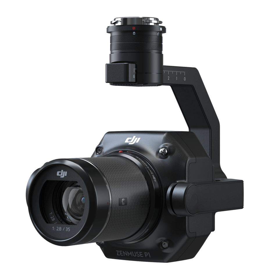
DJI Matrice 400 RTK + Zenmuse P1 RGB Camera
Professional drone configured for high-resolution photogrammetric surveys. The integration of the RGB P1 camera allows the acquisition of high-detail images for the production of orthophotos and three-dimensional models of the territory.
Technical specifications:
- 45 MP full-frame RGB camera for photogrammetric acquisitions
- Global mechanical shutter, shutter speed 1/2000 seconds
- Pixel size from 4.4 µm
- Objective lens 35 mm
Applications: Topographic and cartographic surveys, production of high-resolution orthophotos, 3D modeling of the territory and infrastructure, environmental monitoring, and support for territorial planning.
DJI Matrice 400 RTK + Multispectral MicaSense RedEdge-P Dual
Professional drone configured for environmental monitoring surveys. The integration of the MicaSense RedEdge-P Dual multispectral system allows the simultaneous acquisition of multiple high-resolution spectral bands for detailed analysis of vegetation, soil, and surface waters.
Technical specifications:
- Multispectral imaging system up to 10 bands
- It covers the spectral ranges of the Sentinel-2 and Landsat 8 satellites
- 5.1 MP panchromatic camera for improved spatial resolution
- Dual radiometric calibration with solar light sensor and calibration panel
Applications: Monitoring the health status of vegetation and identification of species, calculation of vegetation indices (NDVI, NDRE), precision agriculture, ecological and forestry studies, surveys of shallow waters.
Do you need drone surveys or remote sensing data?